RSS Google AI Blog
Follow
Mapping the modern world: How S2Vec learns the language of our cities
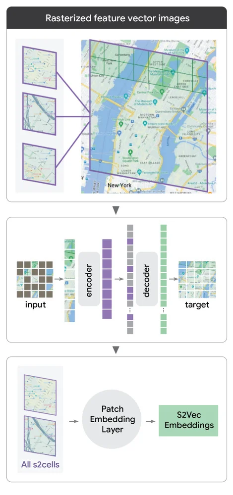
Artificial intelligence in geography often transcends simple navigation, focusing on understanding the built environment's intricate details. Google Research developed S2Vec, a framework to create general-purpose embeddings of the built environment. S2Vec translates geospatial features into a format understandable by machine learning models. This framework uses S2 Geometry to rasterize the world, treating geographical data like an image. Masked autoencoding (MAE) is then used for self-supervised learning, reconstructing hidden map sections to identify patterns. This process generates a unique mathematical shorthand, or embedding, capturing a location's characteristics without manual labeling. S2Vec demonstrated strong performance in predicting socioeconomic metrics like population density. It underperformed in environmental tasks alone, but multimodal fusion with satellite imagery improved results. S2Vec represents a step towards a more general form of geospatial AI, with broad implications. It enables better understanding of infrastructure impacts and more accurate modeling of environmental footprints. The work supports Google's Earth AI mission with other models, like PDFM and RS-MaMMUT.